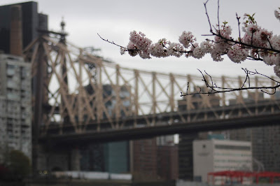
Roosevelt Island is a narrow island in New York City's East River. It lies between Manhattan Island to its west and the borough of Queens, on Long Island, to its east. It is politically part of the borough of Manhattan, and New York County. Running from the equivalent of East 46th to 85th Streets on Manhattan Island, it is about 2 miles (3.2 km) long, with a maximum width of 800 feet (240 m), and a total area of 147 acres (0.59 km2). Together with Mill Rock, Roosevelt Island constitutes Manhattan's Census Tract 238, which has a land area of 0.279 sq mi (0.72 km2),[3] and had a population of 9,520 as of the 2000 United States Census.[4][note 1] It had a population of 11,661 as of the 2010 United States Census.[1] wiki
Saturday, April 27, 2019
Subscribe to:
Post Comments (Atom)


The island was called Minnehanonck by the Lenape and Varkens Eylandt (Hog Island) by New Netherlanders, and during the colonial era and later as Blackwell's Island. It was known as Welfare Island when it was used principally for hospitals, from 1921 to 1973.[5] It was renamed Roosevelt Island (after Franklin D. Roosevelt) in 1973.[6]
ReplyDeleteRoosevelt Island is owned by the city but was leased to New York state's Urban Development Corporation for 99 years in 1969. Most of the residential buildings on Roosevelt Island are rental buildings. There is also a cooperative named Rivercross and a condominium building named Riverwalk. One rental building (Eastwood) has left New York State's Mitchell-Lama Housing Program, though current residents are still protected. It is now called Roosevelt Landings. There are attempts to privatize three other buildings, including the cooperative. wiki